New environmental exposure data added to CanPath: Greenness, air quality, and accessibility

CanPath is excited to continue collaborating with the CIHR-funded Canadian Urban Environmental Health Research Consortium (CANUE) by linking a third round of environmental exposure data to the national harmonized CanPath datasets. Since 2016, CANUE has gathered and standardized environmental exposure data on air and noise pollution, land use, community amenities, green spaces, climate, and socioeconomic conditions. This data is then linked to Canadian cohort studies and health databases. CANUE and CanPath conducted their first linkage activity in May 2019, followed by a second round of linkage in June 2021. The CANUE environmental exposure data was merged with CanPath’s national harmonized datasets using participants’ 6-digit residential postal codes and are available to researchers. This year, 17 new datasets were added to the existing 27 environmental exposure datasets, providing additional measures of greenness, air quality, accessibility, and socioeconomic factors. “The key strength of CanPath’s collaboration with CANUE is the wide-ranging environmental exposures captured, allowing for diverse analyses beyond disease prevention, including developing healthier environments,” says Sheraz Cheema, CanPath Data Manager. “This longitudinal data is invaluable for researchers assessing prolonged exposure impacts on health. CanPath aims to continue collecting data for 20-30 years, increasing its value over time.” Green spaces and vegetation CANUE develops data on neighbourhood greenness from two main sources. First, the MODIS satellite program has provided a consistent measure of greenness across Canada from 2000 to 2023, using a single sensor to ensure data reliability at a 250-meter resolution. Greenness is measured using the Normalized Difference Vegetation Index (NDVI) scale to characterize an area’s vegetation density. Secondly, the Landsat-based Vegetative Greenness Fractions dataset offers a finer 30-meter resolution and measures greenness. This dataset can even detect roads and buildings beneath tree canopies, offering a more detailed view. “This could be an excellent opportunity to study those vertical layers,” says Joey Syer, CANUE Data Director, “as opposed to just the horizontal layer of greenness.” New datasets linked to CanPath include: Advanced Very High-Resolution Radiometer (AVHRR) Normalized Difference Vegetation Index (NDVI) (2000-2013) Landsat – Greenest Pixel (2000-2017) Landsat – Growing Season (2000-2019) Moderate Resolution Imaging Spectroradiometer (MODIS) – Annual Max (2000-2023) MODIS – Annual Mean (2000-2023) MODIS – Growing Season Max (2000-2023) MODIS – Growing Season Mean (2000-2023) Air quality One of the relatively new datasets in CANUE’s data holdings is the Canadian Optimized Statistical Smoke Model (CanOSSEM), which Naman Paul and colleagues developed at the BC Centre for Disease Control. This dataset estimates fine particulate matter (PM2.5) and is optimized for wildfire smoke. CANUE has data from 2010 to 2022 at daily, monthly, and annual scales, and it comes on a 5 km by 5 km grid. “The variation within those five kilometres is probably not much,” says Joey, “but the fact that this data covers all of Canada makes this an unparalleled resource in terms of space and time attributes. It’s really deserving of usage and study.” New datasets include: Fine Particulate Matter (PM2.5 v4) (2000-2020) Fine Particulate Matter (PM2.5 v5) (2000-2021) Smoke Exposure (PM2.5 v2) (2010-2022) Accessibility and transportation The CanPath data assets have also been updated with many new datasets in the ‘neighbourhoods’ domain. These include the Canadian Bikeway Comfort and Safety Classification System (Can-BICS) metrics, which measure the quantity and quality of cycling infrastructure in Canadian communities, and several spatial accessibility indicators, which provide information on access to different services and amenities. “By linking these and other CANUE datasets to CanPath data, we can explore how the built environment affects chronic health conditions like never before,” says Dr. Dany Doiron, CANUE Managing Director. New datasets include: Spatial Accessibility Measures (2021) Public Transportation (2019) Canadian Bikeway Safety Metrics (Can-BICS) (2021) Street Connectivity (2019) Other socioeconomic factors Many other socioeconomic factors can provide valuable insights into how the built environment and access to healthy food impact chronic diseases, including cancer risk and prevention. Dr. Trevor Dummer, CanPath National Scientific Co-Director, spoke about his role as a health geographer: “My interest in cancer prevention is understanding how the built environment and natural environment influences our cancer risk. This includes how our behaviours, such as physical activity or access to healthy food, are impacted by our geography. CanPath, as a longitudinal cohort linked to CANUE geospatial information and cancer registry data, has vast potential for epidemiological analysis to identify cancer risk factors and support prevention.” New datasets include: Building Density (2019) Dwellings Needing Repair (2016-2021) Canadian Food Environment Dataset (Can-FED) (2018)

Data Services in New Brunswick and Nova Scotia

Our team was glad to attend the Maritime SPOR SUPPORT Unit (MSSU) webinar today to hear about the data services available in New Brunswick and Nova Scotia. Atlantic PATH data is linked to administrative data with the New Brunswick Institute for Research, Data and Training (NB-IRDT) and Health Data Nova Scotia (HDNS). Please feel free to reach out to any of our teams for more information!

Administrative Health Data Services in the Maritimes Webinar

Join the Maritime SPOR Support Unit to learn about accessing data administrative health data with Health Data Nova Scotia and the New Brunswick Institute for Research, Data and Training, including linked data sources from Atlantic PATH and the Canadian Longitudinal Study on Aging! Thursday, Oct 17th, 12-1pm AST Registration: https://t.co/r8r6KevJht

Predicting chronic disease enabled by New Brunswick and Nova Scotia data linkage

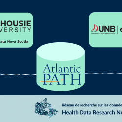
  FOR IMMEDIATE RELEASE – Wednesday, June 5, 2024 Predicting chronic disease enabled by New Brunswick and Nova Scotia data linkage Predicting chronic disease has gotten faster and simpler with the linkage of data gathered from a longitudinal study involving over 34,000 participants and administrative health data routinely gathered by New Brunswick and Nova Scotia. A collaboration between the Atlantic Partnership for Tomorrow’s Health (Atlantic PATH) and New Brunswick Institute for Research, Data & Training (NB-IRDT), and Health Data Nova Scotia (HDNS) is an important opportunity for advancing health research. “I am absolutely thrilled to see these linkages happen,” said Dr. Robin Urquhart, Atlantic PATH Scientific Director. “Atlantic PATH is an incredibly rich resource to understand the health of Atlantic Canadians and all of the different factors, like our biology, behaviours, and environments, that impact our health. This new linkage activity makes our resource more powerful, giving us access to different sources of data to answer complex health questions affecting all Atlantic Canadians.” Atlantic PATH follows the health of participants from all four Atlantic Canadian provinces to help researchers discover why some people develop certain chronic diseases and cancers and others don’t in order to advance prevention and early diagnosis. Atlantic PATH is part of the Canadian Partnership for Tomorrow’s Health (CanPath), a pan-Canadian, longitudinal cohort studying Canadians’ health, behaviours and environments. “Not only is this historical, record-level data linkage activity, this work is crucial for Atlantic Canada, which has among the country’s highest rates of chronic disease and cancer,” said Dr. Ted McDonald, director of NB-IRDT. “Critically, it will enable researchers to focus on studies related to cancer and chronic disease that cannot be undertaken without linking the separate data sources. The data linkage has other important implications too, such as the potential to inform health policy and improve detection, prevention and treatment.” Based at the University of New Brunswick, NB-IRDT provides researchers with secure access to pseudonymized personal level administrative data and conducts research on policy topics to support evidence informed government decision-making. NB-IRDT is a member of Health Data Research Network Canada, a pan-Canadian network of data centres and research organizations. HDRN Canada facilitates access to multi-regional administrative data to address health challenges that cross boundaries and foster improvements in health and health equity. Within the Department of Community Health and Epidemiology at Dalhousie University, HDNS facilitates research and innovation in Nova Scotia by providing access to linkable administrative health data and analysis for research purposes in a remote, secure, controlled environment. HDNS is also a member of HDRN Canada. “This is an exciting opportunity for researchers across the Maritimes,” said Dr. Sam Stewart, director of HDNS. “Research cohorts like Atlantic PATH take a tremendous amount of work to collect, so it is paramount that we do everything we can to make that data as effective as possible. Linking Atlantic PATH data to the data resources at HDNS and NB-IRDT will enable researchers to discover key, long-term insights into the health of Canadians, and signal an important step forward in how research data can be leveraged and enhanced within the healthcare system.” “This is an exciting development, as this linkage includes data from participants in two provinces, so it is already multi-regional in nature,” said Dr. Kim McGrail, HDRN Canada Scientific Director. “It also builds on linkage of other regional CanPath cohorts across Canada, creating many new research opportunities that can help us to better understand chronic disease and how to prevent them.” New Brunswick and Nova Scotia are the first Atlantic Canadian provinces to link to Atlantic PATH, the result of a long and deliberate collaboration involving HDRN Canada, Atlantic PATH, CanPath, and administrative data holders in the four Atlantic provinces. Since the transfer of Atlantic PATH baseline data holdings to NB-IRDT and HDNS, researchers can now apply to link Atlantic PATH data to provincial administrative data holdings, such as screenings, hospitalizations, medication use, health outcomes and more. View the NB data holdings here View the NS data holdings here. MEDIA CONTACT: Dr. Kate Milberry Strategic Communications Manager HDRN Canada kate.milberry@hdrn.ca 604.306.1512